


<< Text Pages >> Giant's Grave (Marshland) - Round Barrow(s) in England in Norfolk
Submitted by coldrum on Sunday, 31 May 2026 Page Views: 1324
Neolithic and Bronze AgeSite Name: Giant's Grave (Marshland)Country: England
NOTE: This site is 7.4 km away from the location you searched for.
County: Norfolk Type: Round Barrow(s)
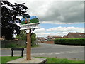
Nearest Village: Marshland St. James
Map Ref: TF5237009830
Latitude: 52.664775N Longitude: 0.251678E
Condition:
| 5 | Perfect |
| 4 | Almost Perfect |
| 3 | Reasonable but with some damage |
| 2 | Ruined but still recognisable as an ancient site |
| 1 | Pretty much destroyed, possibly visible as crop marks |
| 0 | No data. |
| -1 | Completely destroyed |
| 5 | Superb |
| 4 | Good |
| 3 | Ordinary |
| 2 | Not Good |
| 1 | Awful |
| 0 | No data. |
| 5 | Can be driven to, probably with disabled access |
| 4 | Short walk on a footpath |
| 3 | Requiring a bit more of a walk |
| 2 | A long walk |
| 1 | In the middle of nowhere, a nightmare to find |
| 0 | No data. |
| 5 | co-ordinates taken by GPS or official recorded co-ordinates |
| 4 | co-ordinates scaled from a detailed map |
| 3 | co-ordinates scaled from a bad map |
| 2 | co-ordinates of the nearest village |
| 1 | co-ordinates of the nearest town |
| 0 | no data |
Internal Links:
External Links:
Round Barrow(s) in Norfolk
A possible Bronze Age Barrow, associated in folklore with Tom Hickathrift.
The giant is an ogre he killed in the district who was then buried beneath a mound.
The earthwork was destroyed in the 19th century.
http://www.heritage.norfolk.gov.uk/record-details?MNF2390-Tom-Hickathrift%27s-washbowl-and-Giant%27s-Grave&Index=2&RecordCount=1&SessionID=972954b8-c57b-4359-9d0c-51b3d34850ab
You may be viewing yesterday's version of this page. To see the most up to date information please register for a free account.
Do not use the above information on other web sites or publications without permission of the contributor.
Nearby Images from Geograph Britain and Ireland:

©2015(licence)

©2015(licence)

©2020(licence)

©2025(licence)
©2019(licence)
The above images may not be of the site on this page, they are loaded from Geograph.
Please Submit an Image of this site or go out and take one for us!
Click here to see more info for this site
Nearby sites
Key: Red: member's photo, Blue: 3rd party photo, Yellow: other image, Green: no photo - please go there and take one, Grey: site destroyed
Download sites to:
KML (Google Earth)
GPX (GPS waypoints)
CSV (Garmin/Navman)
CSV (Excel)
To unlock full downloads you need to sign up as a Contributory Member. Otherwise downloads are limited to 50 sites.
Turn off the page maps and other distractions
Nearby sites listing. In the following links * = Image available
1m E 90° Tom Hickathrift's Washbowl Round Barrow(s) (TF5237009830)
14.0km NE 45° Kings Lynn Museum* Museum (TF62022005)
15.2km ENE 66° Middleton Mount Artificial Mound (TF66121639)
17.6km SSW 197° Manea Cursus Cursus (TL478928)
17.9km SSW 206° Wimblington Cursus Cursus (TL44979351)
17.9km ESE 121° St. Margaret's Well (Wereham)* Holy Well or Sacred Spring (TF6801)
18.4km SSW 206° Stonea Camp* Hillfort (TL448930)
22.1km E 92° Bichamditch Misc. Earthwork (TF7458009680)
22.8km E 95° Hangour Hill Round Barrow(s) (TF7520008700)
22.9km E 84° Narborough Camp Hillfort Hillfort (TF75141308)
23.0km ENE 60° St. Botolph's Springs Holy Well or Sacred Spring (TF7210021800)
24.3km E 92° The Cowell Stone Natural Stone / Erratic / Other Natural Feature (TF7673509558)
26.8km WSW 259° Pode Hole Farm Round Barrow(s) (TF262037)
27.2km W 274° Crowland Henge* Henge (TF25061086)
27.7km ESE 104° St Mary’s Chapel, Cockley Cley* Ancient Temple (TF79550411)
28.2km S 191° Wardy Hill* Hillfort (TL478820)
28.3km ESE 103° Cockley Cley Iceni Village* Museum (TF802043)
29.4km E 93° Swaffham Settlement Stone* Natural Stone / Erratic / Other Natural Feature (TF8181009038)
29.4km S 178° Ely Museum* Museum (TL5405980463)
29.8km NE 53° Harpley Common Barrow Cemetery* Barrow Cemetery (TF7550028700)
30.2km WSW 256° Oliver Cromwell's Hill (Eye) Cairn (TF232018)
31.0km SE 128° Weeting Stump Cross* Ancient Cross (TL77359137)
31.1km SE 128° Mount Ephraim Barrows* Barrow Cemetery (TL7750191453)
31.1km WSW 249° Must Farm* Ancient Village or Settlement (TL2370097600)
31.5km WSW 252° Flag Fen Visitors Centre* Museum (TL227989)
View more nearby sites and additional images


 We would like to know more about this location. Please feel free to add a brief description and any relevant information in your own language.
 Wir möchten mehr über diese Stätte erfahren. Bitte zögern Sie nicht, eine kurze Beschreibung und relevante Informationen in Deutsch hinzuzufügen.
 Nous aimerions en savoir encore un peu sur les lieux. S'il vous plaît n'hesitez pas à ajouter une courte description et tous les renseignements pertinents dans votre propre langue.
 Quisieramos informarnos un poco más de las lugares. No dude en añadir una breve descripción y otros datos relevantes en su propio idioma.