


<< Text Pages >> Middleton Mount - Artificial Mound in England in Norfolk
Submitted by DruidTeacher on Thursday, 11 August 2016 Page Views: 3666
Multi-periodSite Name: Middleton MountCountry: England
NOTE: This site is 7.4 km away from the location you searched for.
County: Norfolk Type: Artificial Mound
Nearest Town: Kings Lynn Nearest Village: Middleton
Map Ref: TF66121639
Latitude: 52.719658N Longitude: 0.458114E
Condition:
| 5 | Perfect |
| 4 | Almost Perfect |
| 3 | Reasonable but with some damage |
| 2 | Ruined but still recognisable as an ancient site |
| 1 | Pretty much destroyed, possibly visible as crop marks |
| 0 | No data. |
| -1 | Completely destroyed |
| 5 | Superb |
| 4 | Good |
| 3 | Ordinary |
| 2 | Not Good |
| 1 | Awful |
| 0 | No data. |
| 5 | Can be driven to, probably with disabled access |
| 4 | Short walk on a footpath |
| 3 | Requiring a bit more of a walk |
| 2 | A long walk |
| 1 | In the middle of nowhere, a nightmare to find |
| 0 | No data. |
| 5 | co-ordinates taken by GPS or official recorded co-ordinates |
| 4 | co-ordinates scaled from a detailed map |
| 3 | co-ordinates scaled from a bad map |
| 2 | co-ordinates of the nearest village |
| 1 | co-ordinates of the nearest town |
| 0 | no data |
Internal Links:
External Links:
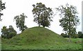
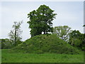
Artificial Mound in England
I thought this may be of interest to site viewers. Although not ancient as the castle dates from the 11th century, the energy here is amazing. I dowsed yesterday with rods and bobber.
A timber keep once stood upon the motte. To the east of the motte, the grassed area which visitors enter when they first arrive at the site was once the castle bailey. This was an area enclosed by a bank and ditch which contained dwellings, stables, workshops and outbuildings.
You may be viewing yesterday's version of this page. To see the most up to date information please register for a free account.
Do not use the above information on other web sites or publications without permission of the contributor.
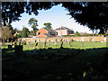
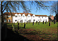
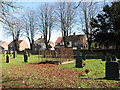
Nearby Images from Geograph Britain and Ireland:
©2006(licence)
©2017(licence)
©2010(licence)
©2010(licence)
©2010(licence)
The above images may not be of the site on this page, they are loaded from Geograph.
Please Submit an Image of this site or go out and take one for us!
Click here to see more info for this site
Nearby sites
Key: Red: member's photo, Blue: 3rd party photo, Yellow: other image, Green: no photo - please go there and take one, Grey: site destroyed
Download sites to:
KML (Google Earth)
GPX (GPS waypoints)
CSV (Garmin/Navman)
CSV (Excel)
To unlock full downloads you need to sign up as a Contributory Member. Otherwise downloads are limited to 50 sites.
Turn off the page maps and other distractions
Nearby sites listing. In the following links * = Image available
5.5km NW 314° Kings Lynn Museum* Museum (TF62022005)
8.0km NE 50° St. Botolph's Springs Holy Well or Sacred Spring (TF7210021800)
9.6km ESE 112° Narborough Camp Hillfort Hillfort (TF75141308)
10.8km SE 130° Bichamditch Misc. Earthwork (TF7458009680)
11.9km SE 132° Hangour Hill Round Barrow(s) (TF7520008700)
12.6km SE 125° The Cowell Stone Natural Stone / Erratic / Other Natural Feature (TF7673509558)
15.2km WSW 246° Giant's Grave (Marshland) Round Barrow(s) (TF5237009830)
15.2km WSW 246° Tom Hickathrift's Washbowl Round Barrow(s) (TF5237009830)
15.4km NE 39° Harpley Common Barrow Cemetery* Barrow Cemetery (TF7550028700)
15.5km S 175° St. Margaret's Well (Wereham)* Holy Well or Sacred Spring (TF6801)
17.2km ENE 61° West Rudham South* Long Barrow (TF8094125116)
17.3km ESE 117° Swaffham Settlement Stone* Natural Stone / Erratic / Other Natural Feature (TF8181009038)
17.3km ENE 61° West Rudham Cursus Cursus (TF810254)
17.4km ENE 61° West Rudham North* Long Barrow (TF8104325337)
17.7km ENE 63° West Rudham* Round Barrow(s) (TF81652495)
18.2km SE 134° St Mary’s Chapel, Cockley Cley* Ancient Temple (TF79550411)
18.2km NE 41° Bircham Common Barrows* Barrow Cemetery (TF775306)
18.5km SE 133° Cockley Cley Iceni Village* Museum (TF802043)
19.4km E 82° Weasenham Plantation* Barrow Cemetery (TF853198)
19.6km ENE 63° Fox Covert Bowl Barrows (West Rudham)* Round Barrow(s) (TF8339525782)
20.1km NNE 15° Sedgeford Iron Age Settlement* Ancient Village or Settlement (TF705360)
20.4km E 89° Great Wood Round Barrow(s) (TF8659017560)
20.5km E 81° Litcham Heath* Round Barrow(s) (TF863202)
22.5km NE 52° Coxford Heath Barrow Round Barrow(s) (TF83493070)
22.9km NE 53° Wicken Covert Barrow Round Barrow(s) (TF83973081)
View more nearby sites and additional images


 We would like to know more about this location. Please feel free to add a brief description and any relevant information in your own language.
 Wir möchten mehr über diese Stätte erfahren. Bitte zögern Sie nicht, eine kurze Beschreibung und relevante Informationen in Deutsch hinzuzufügen.
 Nous aimerions en savoir encore un peu sur les lieux. S'il vous plaît n'hesitez pas à ajouter une courte description et tous les renseignements pertinents dans votre propre langue.
 Quisieramos informarnos un poco más de las lugares. No dude en añadir una breve descripción y otros datos relevantes en su propio idioma.