<< Our Photo Pages >> Gorrick’s Well - Holy Well or Sacred Spring in England in Buckinghamshire
Submitted by LouisaJaneReece on Tuesday, 25 June 2024 Page Views: 8889
Springs and Holy WellsSite Name: Gorrick’s WellCountry: England County: Buckinghamshire Type: Holy Well or Sacred Spring
Nearest Town: Milton Keynes Nearest Village: Calverton
Map Ref: SP78803930
Latitude: 52.046502N Longitude: 0.852394W
Condition:
| 5 | Perfect |
| 4 | Almost Perfect |
| 3 | Reasonable but with some damage |
| 2 | Ruined but still recognisable as an ancient site |
| 1 | Pretty much destroyed, possibly visible as crop marks |
| 0 | No data. |
| -1 | Completely destroyed |
| 5 | Superb |
| 4 | Good |
| 3 | Ordinary |
| 2 | Not Good |
| 1 | Awful |
| 0 | No data. |
| 5 | Can be driven to, probably with disabled access |
| 4 | Short walk on a footpath |
| 3 | Requiring a bit more of a walk |
| 2 | A long walk |
| 1 | In the middle of nowhere, a nightmare to find |
| 0 | No data. |
| 5 | co-ordinates taken by GPS or official recorded co-ordinates |
| 4 | co-ordinates scaled from a detailed map |
| 3 | co-ordinates scaled from a bad map |
| 2 | co-ordinates of the nearest village |
| 1 | co-ordinates of the nearest town |
| 0 | no data |
Internal Links:
External Links:
I have visited· I would like to visit
HSapien Chriski would like to visit
")
According to James Rattue in “The Holy wells of Buckinghamshire” local folklore tells how a witch’s pupil gave the sight back to a Gypsy tinker. The rhyme from “Romance around Stoney Stratford” “When Gorrick’s Spring flows fast and clear, Stoop down and drink, for health is here, If Gorrick’s Spring shuld e’er run dry, Beware, for pestilence is nigh.”
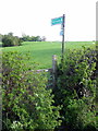
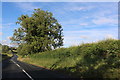
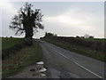
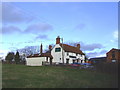
Location: Calverton village on Calverton Road there is a lay-by (see Google maps). There is a section fenced off with no public access on the left, but there are some slab steps to the right which will take you to the spring (see image with arrow). You will need to wear suitable clothing as you’ll have to wade through Stinging Nettles and Brambles but it’s well worth the effort.
The Northern Antiquarian (TNA) also feature a page for this healing well - see their entry for Gorrick’s Spring, Calverton, Buckinghamshire, which has details for finding this site, photographs, a brief archaeology & history and local folklore.
TNA also include a link to 'in search of holy wells and healing springs' which discusses this well and also St. Rumbolds Well. - see Holy and Healing Wells.
Page originally by HOLYWELL
You may be viewing yesterday's version of this page. To see the most up to date information please register for a free account.
")
")
Do not use the above information on other web sites or publications without permission of the contributor.
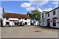
Nearby Images from Geograph Britain and Ireland:
©2012(licence)
©2020(licence)
©2011(licence)
©2011(licence)
©2006(licence)
The above images may not be of the site on this page, they are loaded from Geograph.
Please Submit an Image of this site or go out and take one for us!
Click here to see more info for this site
Nearby sites
Key: Red: member's photo, Blue: 3rd party photo, Yellow: other image, Green: no photo - please go there and take one, Grey: site destroyed
Download sites to:
KML (Google Earth)
GPX (GPS waypoints)
CSV (Garmin/Navman)
CSV (Excel)
To unlock full downloads you need to sign up as a Contributory Member. Otherwise downloads are limited to 50 sites.
Turn off the page maps and other distractions
Nearby sites listing. In the following links * = Image available
2.7km N 5° St. Vincent's Well Holy Well or Sacred Spring (SP7942)
5.7km SSE 165° Whaddon Barrow* Round Barrow(s)
8.2km SW 224° Thornborough (Bucks)* Barrow Cemetery (SP732333)
8.7km NE 51° Gayhurst Barrow cemetery Barrow Cemetery (SP855448)
8.8km E 83° Millennium Medicine Wheel* Stone Circle (SP8758740483)
9.7km SE 144° St. John's Well (Buckinghamshire)* Holy Well or Sacred Spring (SP847316)
11.0km ESE 110° Caldecotte Cursus Cursus (SP892357)
11.4km WSW 241° St Rumwald's Well* Holy Well or Sacred Spring (SP6896133551)
13.2km NNE 28° Holy Well (Ravenstone)* Holy Well or Sacred Spring (SP849510)
14.1km ESE 110° Danesborough Hillfort Hillfort (SP922348)
14.4km SSW 196° Sionhill Farm Henge (SP75012541)
15.4km SE 143° Soulbury Stone* Natural Stone / Erratic / Other Natural Feature (SP88292709)
15.8km SSW 202° Botyl Well* Holy Well or Sacred Spring (SP732245)
16.1km NNE 29° Holy Well (Olney)* Holy Well or Sacred Spring (SP864535)
16.8km S 185° Scorne Well* Holy Well or Sacred Spring (SP777225)
17.2km SE 137° Linslade Holy Well Holy Well or Sacred Spring (SP908270)
17.5km E 81° Holywell (Cranfield)* Holy Well or Sacred Spring (SP961424)
18.0km SE 134° Shepherd's Race (Heath)* Turf Maze (SP9227)
18.6km S 175° Whitchurch Holy Well Holy Well or Sacred Spring (SP806208)
18.6km S 177° Fair Alice well Holy Well or Sacred Spring (SP800207)
18.6km S 177° Whittle Hole* Holy Well or Sacred Spring (SP801207)
18.7km S 176° Holy Well (Whitchurch)* Holy Well or Sacred Spring (SP805207)
19.7km NNW 346° Hunsbury* Hillfort (SP738584)
20.0km NE 50° Nell's Well* Holy Well or Sacred Spring (SP941523)
20.8km NNW 343° Upton Bowl Barrow Barrow Cemetery (SP72355909)
View more nearby sites and additional images


 We would like to know more about this location. Please feel free to add a brief description and any relevant information in your own language.
 Wir möchten mehr über diese Stätte erfahren. Bitte zögern Sie nicht, eine kurze Beschreibung und relevante Informationen in Deutsch hinzuzufügen.
 Nous aimerions en savoir encore un peu sur les lieux. S'il vous plaît n'hesitez pas à ajouter une courte description et tous les renseignements pertinents dans votre propre langue.
 Quisieramos informarnos un poco más de las lugares. No dude en añadir una breve descripción y otros datos relevantes en su propio idioma.