


<< Text Pages >> The Birch Well - Holy Well or Sacred Spring in England in Greater London
Submitted by Anonymous on Sunday, 27 July 2025 Page Views: 1314
Springs and Holy WellsSite Name: The Birch Well Alternative Name: the Holly wellCountry: England
NOTE: This site is 2.7 km away from the location you searched for.
County: Greater London Type: Holy Well or Sacred Spring
Nearest Town: Snaresbrook
Map Ref: TQ3974588924
Latitude: 51.581857N Longitude: 0.015502E
Condition:
| 5 | Perfect |
| 4 | Almost Perfect |
| 3 | Reasonable but with some damage |
| 2 | Ruined but still recognisable as an ancient site |
| 1 | Pretty much destroyed, possibly visible as crop marks |
| 0 | No data. |
| -1 | Completely destroyed |
| 5 | Superb |
| 4 | Good |
| 3 | Ordinary |
| 2 | Not Good |
| 1 | Awful |
| 0 | No data. |
| 5 | Can be driven to, probably with disabled access |
| 4 | Short walk on a footpath |
| 3 | Requiring a bit more of a walk |
| 2 | A long walk |
| 1 | In the middle of nowhere, a nightmare to find |
| 0 | No data. |
| 5 | co-ordinates taken by GPS or official recorded co-ordinates |
| 4 | co-ordinates scaled from a detailed map |
| 3 | co-ordinates scaled from a bad map |
| 2 | co-ordinates of the nearest village |
| 1 | co-ordinates of the nearest town |
| 0 | no data |
Internal Links:
External Links:
Holy Well or Sacred Spring in Greater London
The Birch Well is situated on Leyton Flats in a Birch Wood near to the boundary fence of Snaresbrook Crown Court. It is not far from the Eagle Pond, and is now a stone-edged pool about 1.5 metres long and somewhat oval in shape.
Though apparently little known and easily overlooked now, it was once perhaps the most important of the public wells that supplied Wanstead with its drinking water. Most of these have been long forgotten, though there are still some remnants of the private wells that the more wealthy inhabitants of the village once used.
Birch Well was used for drinking water only - it was once said by an elderly inhabitant of the area that "no water was ever as fresh, cool, sparkling and reviving as that which was drawn from Wanstead's well."
When in use, it was apparently in the form of something of a large square gravel pit with wooden steps and stagings, with a bucket and a barrel. Even after the well was given a brick surround, there was still at least one drowning attributed to the site!
People who lived outside of the parish boundary also used the well, but they were charged at the rate of a penny for three buckets or 1/6d for a buttful.http://www.wansteadwildlife.org.uk/index.php/en/the-study-area112/leyton-flats/birch-well<3><4>
You may be viewing yesterday's version of this page. To see the most up to date information please register for a free account.
Do not use the above information on other web sites or publications without permission of the contributor.
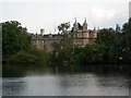
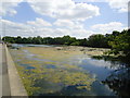
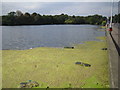
Nearby Images from Geograph Britain and Ireland:
©2006(licence)
©2011(licence)
©2006(licence)
©2007(licence)

©2013(licence)
The above images may not be of the site on this page, they are loaded from Geograph.
Please Submit an Image of this site or go out and take one for us!
Click here to see more info for this site
Nearby sites
Key: Red: member's photo, Blue: 3rd party photo, Yellow: other image, Green: no photo - please go there and take one, Grey: site destroyed
Download sites to:
KML (Google Earth)
GPX (GPS waypoints)
CSV (Garmin/Navman)
CSV (Excel)
To unlock full downloads you need to sign up as a Contributory Member. Otherwise downloads are limited to 50 sites.
Turn off the page maps and other distractions
Nearby sites listing. In the following links * = Image available
838m S 170° The High Stone of Snaresbrook Marker Stone (TQ3991388103)
2.0km NNW 346° Gipsy Smith* Modern Stone Circle etc (TQ392909)
6.0km W 277° St. Eloy's Well* Holy Well or Sacred Spring (TQ338895)
6.1km NNW 348° Pole Hill* Modern Stone Circle etc (TQ383949)
6.4km SE 126° Holy well (Barking) Holy Well or Sacred Spring (TQ450853)
7.3km E 86° St Chad's Well (Chadwell Heath)* Holy Well or Sacred Spring (TQ4706389580)
8.0km W 262° Finsbury Park earthworks* Artificial Mound (TQ3186087537)
8.6km ESE 107° Valence House* Museum (TQ4803386569)
8.8km NNE 15° Loughton Camp* Hillfort (TQ418975)
9.7km N 9° High Beach* Artificial Mound (TQ410985)
10.1km NW 313° Bush Hill Hillfort (TQ321956)
10.3km SW 219° St Olave's Well* Holy Well or Sacred Spring (TQ335807)
10.3km SW 222° Roman Basilica at 85 Gracechurch Street* Ancient Palace (TQ3303481051)
10.4km SW 219° All Hallows by the Tower* Museum (TQ3337380695)
10.5km W 280° St. Dunstan's Well Holy Well or Sacred Spring (TQ293905)
10.6km SW 227° Museum of London* Museum (TQ321815)
10.7km SW 230° Cow Cross (Finsbury) Ancient Cross (TQ31788181)
10.7km SW 223° London Stone* Marker Stone (TQ3267680903)
10.7km SW 224° Mithras Temple (London)* Ancient Temple (TQ3252181031)
10.7km SW 232° Clerk's Well (Farringdon Lane) Holy Well or Sacred Spring (TQ3145282134)
10.8km SW 233° Skinner's Well (Finsbury) Holy Well or Sacred Spring (TQ313822)
10.8km SW 226° Broken Cross (Westminster) Ancient Cross (TQ322812)
10.9km W 277° Mus Well (Muswell Hill) Holy Well or Sacred Spring (TQ28869001)
11.3km SW 228° Bridewell (Fleet Street) Holy Well or Sacred Spring (TQ315812)
11.3km WSW 237° Coram* Modern Stone Circle etc (TQ3044582417)
View more nearby sites and additional images


 We would like to know more about this location. Please feel free to add a brief description and any relevant information in your own language.
 Wir möchten mehr über diese Stätte erfahren. Bitte zögern Sie nicht, eine kurze Beschreibung und relevante Informationen in Deutsch hinzuzufügen.
 Nous aimerions en savoir encore un peu sur les lieux. S'il vous plaît n'hesitez pas à ajouter une courte description et tous les renseignements pertinents dans votre propre langue.
 Quisieramos informarnos un poco más de las lugares. No dude en añadir una breve descripción y otros datos relevantes en su propio idioma.