


<< Text Pages >> Butstone (Banwell) - Marker Stone in England in Somerset
Submitted by Andy B on Saturday, 11 May 2024 Page Views: 716
Neolithic and Bronze AgeSite Name: Butstone (Banwell)Country: England
NOTE: This site is 0.212 km away from the location you searched for.
County: Somerset Type: Marker Stone
Map Ref: ST398590
Latitude: 51.326898N Longitude: 2.865374W
Condition:
| 5 | Perfect |
| 4 | Almost Perfect |
| 3 | Reasonable but with some damage |
| 2 | Ruined but still recognisable as an ancient site |
| 1 | Pretty much destroyed, possibly visible as crop marks |
| 0 | No data. |
| -1 | Completely destroyed |
| 5 | Superb |
| 4 | Good |
| 3 | Ordinary |
| 2 | Not Good |
| 1 | Awful |
| 0 | No data. |
| 5 | Can be driven to, probably with disabled access |
| 4 | Short walk on a footpath |
| 3 | Requiring a bit more of a walk |
| 2 | A long walk |
| 1 | In the middle of nowhere, a nightmare to find |
| 0 | No data. |
| 5 | co-ordinates taken by GPS or official recorded co-ordinates |
| 4 | co-ordinates scaled from a detailed map |
| 3 | co-ordinates scaled from a bad map |
| 2 | co-ordinates of the nearest village |
| 1 | co-ordinates of the nearest town |
| 0 | no data |
Be the first person to rate this site - see the 'Contribute!' box in the right hand menu.
Internal Links:
External Links:
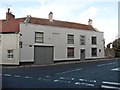
In the heart of Banwell village is the
Butstone, a large conglomerate boulder
lying at the junction of Winscombe
Road and Church Street.
Received wisdom suggests it is a mounting block, a relic form the days when four-legged transport held sway. Its blocky nature rules out the possibility of it being a degraded milestone but its position and the fact it has survived in the heart of a busy village suggest that it has a more interesting past than an aid for over- weight, gouty yeoman farmers. Indeed, it looks very much like a mark stone, those ungainly lumps beloved by Alfred Watkins who insinuated them into his ley line system.
Whatever the true origins of markstones they have an ancient pedigree and it would be fasci- nating to discover more about the Butstone’s past, and what part it played in the sacred landscape of the village, for the stone is literally yards from the old healing spring of Adam’s Well, less than 100m from the huge and pow- erful spring which gave the village its name, and close to the parish church of St Andrew, founded in the 7th Century as part of a monastic establishment.
Source - listed as an extant stone in Phil Quinn's article The Forgotten Stones of
West Mendip, in 3rd Stone Issue 25 (Spring 1997) page 15
Download from here.
You may be viewing yesterday's version of this page. To see the most up to date information please register for a free account.
Do not use the above information on other web sites or publications without permission of the contributor.
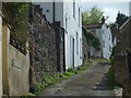
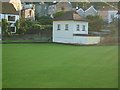
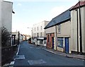
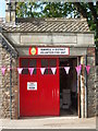
Nearby Images from Geograph Britain and Ireland:
©2019(licence)
©2005(licence)
©2018(licence)
©2019(licence)
©2018(licence)
The above images may not be of the site on this page, they are loaded from Geograph.
Please Submit an Image of this site or go out and take one for us!
Click here to see more info for this site
Nearby sites
Key: Red: member's photo, Blue: 3rd party photo, Yellow: other image, Green: no photo - please go there and take one, Grey: site destroyed
Download sites to:
KML (Google Earth)
GPX (GPS waypoints)
CSV (Garmin/Navman)
CSV (Excel)
To unlock full downloads you need to sign up as a Contributory Member. Otherwise downloads are limited to 50 sites.
Turn off the page maps and other distractions
Nearby sites listing. In the following links * = Image available
1.1km E 89° Banwell Camp* Hillfort (ST4090059000)
1.4km SSW 212° Wook's Quoit* Standing Stone (Menhir) (ST39045783)
2.0km NNE 17° Banwell Moor Stone 2 Marker Stone (ST40406086)
2.3km NNW 339° Banwell Moor Stone 1 Marker Stone (ST39036113)
2.4km SW 234° Flagstaff Hill* Stone Circle (ST3785257630)
2.4km NNW 333° Rolstone* Standing Stone (Menhir) (ST38736120)
2.9km N 355° Banwell Moor Stone 4 Marker Stone (ST39576188)
3.2km SSE 163° Wavering Down cairn* Round Cairn (ST40705590)
3.6km E 98° The Wimblestone* Standing Stone (Menhir) (ST43355848)
3.6km S 182° Compton Bishop Church Cross* Ancient Cross (ST3959955378)
3.8km WSW 238° Loxton Hill Barrows Round Barrow(s) (ST36565704)
3.9km SSW 214° Loxton Churchyard Cross* Ancient Cross (ST3762455813)
4.3km SSE 165° Compton Bishop* Standing Stones (ST409548)
5.1km E 97° Barrow at Rowberrow* Round Barrow(s) (ST44925834)
5.2km E 90° Dolebury Camp* Hillfort (ST450589)
5.6km SE 142° Axbridge Church Wells* Holy Well or Sacred Spring (ST432546)
5.8km SSW 195° Biddisham Churchyard Cross* Ancient Cross (ST3819353429)
6.0km WSW 249° Bleadon Cross* Ancient Cross (ST3411056921)
6.1km NE 38° Congresbury Church Cross* Ancient Cross (ST4359863744)
6.2km ESE 108° Cuck Hill Barrow Round Barrow(s) (ST4567057030)
6.2km NE 38° Congresbury Village Cross* Ancient Cross (ST4373263818)
6.5km SSE 165° Weare Churchyard Cross* Ancient Cross (ST4140952670)
7.1km NNW 333° Wick St Lawrence Village Cross* Ancient Cross (ST3660565388)
7.2km NNE 27° Yatton Churchyard Cross* Ancient Cross (ST4312665395)
7.4km NE 36° Cadbury Hill* Hillfort (ST442649)
View more nearby sites and additional images


 We would like to know more about this location. Please feel free to add a brief description and any relevant information in your own language.
 Wir möchten mehr über diese Stätte erfahren. Bitte zögern Sie nicht, eine kurze Beschreibung und relevante Informationen in Deutsch hinzuzufügen.
 Nous aimerions en savoir encore un peu sur les lieux. S'il vous plaît n'hesitez pas à ajouter une courte description et tous les renseignements pertinents dans votre propre langue.
 Quisieramos informarnos un poco más de las lugares. No dude en añadir una breve descripción y otros datos relevantes en su propio idioma.