<< Our Photo Pages >> Black Prince's Well - Holy Well or Sacred Spring in England in Kent
Submitted by DavidCWoods on Tuesday, 03 May 2005 Page Views: 12631
Springs and Holy WellsSite Name: Black Prince's WellCountry: England
NOTE: This site is 0.208 km away from the location you searched for.
County: Kent Type: Holy Well or Sacred Spring
Nearest Town: Canterbury Nearest Village: Harbledown
Map Ref: TR129581
Latitude: 51.282238N Longitude: 1.051474E
Condition:
| 5 | Perfect |
| 4 | Almost Perfect |
| 3 | Reasonable but with some damage |
| 2 | Ruined but still recognisable as an ancient site |
| 1 | Pretty much destroyed, possibly visible as crop marks |
| 0 | No data. |
| -1 | Completely destroyed |
| 5 | Superb |
| 4 | Good |
| 3 | Ordinary |
| 2 | Not Good |
| 1 | Awful |
| 0 | No data. |
| 5 | Can be driven to, probably with disabled access |
| 4 | Short walk on a footpath |
| 3 | Requiring a bit more of a walk |
| 2 | A long walk |
| 1 | In the middle of nowhere, a nightmare to find |
| 0 | No data. |
| 5 | co-ordinates taken by GPS or official recorded co-ordinates |
| 4 | co-ordinates scaled from a detailed map |
| 3 | co-ordinates scaled from a bad map |
| 2 | co-ordinates of the nearest village |
| 1 | co-ordinates of the nearest town |
| 0 | no data |
Internal Links:
External Links:
I have visited· I would like to visit
mah visited on 11th Sep 2010 - their rating: Cond: 4 Amb: 5 Access: 5
")
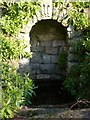
According to Hope, Edward the Black Prince is supposed to have bathed at the well for his leprosy.
St Nicholas’ Hospital, originally for lepers, is still standing and accompanied by a church of the same dedication. The well is best found by passing through the village towards the west and, just past the dip in the road, taking the hairpin turn to the left, then a further left turn into the hospital grounds.
The well is sited on the left hand side of the path just inside the gate and is nicely maintained, with a housing surmounted by the three feathers. A few steps lead down to a pond of cool water.
You may be viewing yesterday's version of this page. To see the most up to date information please register for a free account.
")
")
")
Do not use the above information on other web sites or publications without permission of the contributor.
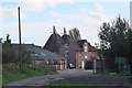
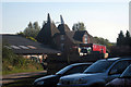
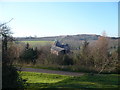
Nearby Images from Geograph Britain and Ireland:
©2015(licence)
©2009(licence)
©2008(licence)

©2009(licence)
©2008(licence)
The above images may not be of the site on this page, they are loaded from Geograph.
Please Submit an Image of this site or go out and take one for us!
Click here to see more info for this site
Nearby sites
Key: Red: member's photo, Blue: 3rd party photo, Yellow: other image, Green: no photo - please go there and take one, Grey: site destroyed
Download sites to:
KML (Google Earth)
GPX (GPS waypoints)
CSV (Garmin/Navman)
CSV (Excel)
To unlock full downloads you need to sign up as a Contributory Member. Otherwise downloads are limited to 50 sites.
Turn off the page maps and other distractions
Nearby sites listing. In the following links * = Image available
1.4km WSW 251° Bigbury Camp* Hillfort (TR116576)
1.8km ESE 103° Museum of Canterbury* Museum (TR1472257767)
2.0km ESE 114° Dane John Mound* Artificial Mound (TR14785737)
2.1km E 87° St Rhadegund's Bath Holy Well or Sacred Spring (TR150583)
2.1km E 98° St. Thomas Becket's Well Holy Well or Sacred Spring (TR150579)
2.1km E 99° Sunwin's Well Holy Well or Sacred Spring (TR15015784)
2.2km E 100° St Thomas's Well (Canterbury)* Holy Well or Sacred Spring (TR151578)
2.5km E 100° St Augustine's Abbey Standing Stone* Ancient Cross (TR1541857755)
4.1km S 176° Iffin Wood Bowl Barrow Round Barrow(s) (TR13335407)
4.8km SW 236° Pilgrims Way 9 Ancient Trackway (TR090552)
5.2km E 82° Fordwich Paleolithic Site Not Known (by us) (TR180590)
5.3km SSE 152° Whitehill Wood Barrow Round Barrow(s) (TR156535)
5.5km ENE 76° Our Lady's Well (Fordwich) Holy Well or Sacred Spring (TR18225970)
5.7km N 1° Clowes Wood Barrows* Round Barrow(s) (TR12746378)
5.8km SE 131° Bridge Iron Age Settlement* Ancient Village or Settlement (TR175545)
6.5km SSW 214° Denge Wood Earthworks Misc. Earthwork (TR095525)
7.0km SSW 194° Mounts Wood Barrow* Round Barrow(s) (TR11455126)
7.0km SSW 213° Denge Wood Tumulus Round Barrow(s) (TR0933852069)
7.1km SW 229° Julliberrie's Grave* Long Barrow (TR077532)
7.2km E 86° Arrianes Well Holy Well or Sacred Spring (TR201589)
7.3km ESE 105° Bekesbourne* Holy Well or Sacred Spring (TR20005646)
7.3km SE 130° Hanging Hill Barrow Cemetary Barrow Cemetery (TR18725363)
7.4km SSE 148° Gorsley Wood Barrows Round Barrow(s) (TR17095201)
7.5km SSE 152° Gorsley Wood Mound Artificial Mound (TR167516)
7.8km SSW 203° Eggringe Wood East Bowl Barrow* Round Barrow(s) (TR10115083)
View more nearby sites and additional images


 We would like to know more about this location. Please feel free to add a brief description and any relevant information in your own language.
 Wir möchten mehr über diese Stätte erfahren. Bitte zögern Sie nicht, eine kurze Beschreibung und relevante Informationen in Deutsch hinzuzufügen.
 Nous aimerions en savoir encore un peu sur les lieux. S'il vous plaît n'hesitez pas à ajouter une courte description et tous les renseignements pertinents dans votre propre langue.
 Quisieramos informarnos un poco más de las lugares. No dude en añadir una breve descripción y otros datos relevantes en su propio idioma.