 with our Megalithic Portal iPhone app")


<< Our Photo Pages >> Parracombe Standing Stone - Standing Stone (Menhir) in England in Devon
Submitted by Energyman on Tuesday, 06 December 2016 Page Views: 2601
Neolithic and Bronze AgeSite Name: Parracombe Standing Stone Alternative Name: Parracombe Common StoneCountry: England
NOTE: This site is 1.338 km away from the location you searched for.
County: Devon Type: Standing Stone (Menhir)
Nearest Town: Parracombe
Map Ref: SS67654522
Latitude: 51.190833N Longitude: 3.895323W
Condition:
| 5 | Perfect |
| 4 | Almost Perfect |
| 3 | Reasonable but with some damage |
| 2 | Ruined but still recognisable as an ancient site |
| 1 | Pretty much destroyed, possibly visible as crop marks |
| 0 | No data. |
| -1 | Completely destroyed |
| 5 | Superb |
| 4 | Good |
| 3 | Ordinary |
| 2 | Not Good |
| 1 | Awful |
| 0 | No data. |
| 5 | Can be driven to, probably with disabled access |
| 4 | Short walk on a footpath |
| 3 | Requiring a bit more of a walk |
| 2 | A long walk |
| 1 | In the middle of nowhere, a nightmare to find |
| 0 | No data. |
| 5 | co-ordinates taken by GPS or official recorded co-ordinates |
| 4 | co-ordinates scaled from a detailed map |
| 3 | co-ordinates scaled from a bad map |
| 2 | co-ordinates of the nearest village |
| 1 | co-ordinates of the nearest town |
| 0 | no data |
Internal Links:
External Links:
")
A small stone, about 1m high, in the middle of a sloping field (slopes down to the east and north). The largest, flat face is probably aligned on 242 true (Kentisbury Down).
You may be viewing yesterday's version of this page. To see the most up to date information please register for a free account.
")
")
")
")
Do not use the above information on other web sites or publications without permission of the contributor.
Nearby Images from Geograph Britain and Ireland:
©2018(licence)
©2013(licence)
©2014(licence)

©2009(licence)

©2014(licence)
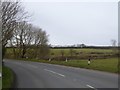
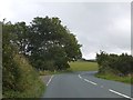
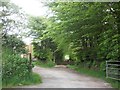
The above images may not be of the site on this page, they are loaded from Geograph.
Please Submit an Image of this site or go out and take one for us!
Click here to see more info for this site
Nearby sites
Key: Red: member's photo, Blue: 3rd party photo, Yellow: other image, Green: no photo - please go there and take one, Grey: site destroyed
Download sites to:
KML (Google Earth)
GPX (GPS waypoints)
CSV (Garmin/Navman)
CSV (Excel)
To unlock full downloads you need to sign up as a Contributory Member. Otherwise downloads are limited to 50 sites.
Turn off the page maps and other distractions
Nearby sites listing. In the following links * = Image available
1.4km WNW 302° Beacon Castle Settlement* Ancient Village or Settlement (SS6645946010)
1.6km E 100° Woolhanger henge* Henge (SS692449)
2.1km ESE 102° South Common Settlement* Ancient Village or Settlement (SS69704474)
2.3km WNW 294° Voley Castle Settlement* Ancient Village or Settlement (SS65564623)
2.6km WNW 297° Heale Down* Standing Stone (Menhir) (SS65384645)
2.7km SE 127° Chapman Barrows* Barrow Cemetery (SS698435)
2.8km SE 130° Chapman Barrows Quincunx* Standing Stones (SS69794333)
2.9km W 280° West Middleton Multiple Stone Rows / Avenue (SS648458)
3.1km SE 129° Chapman Down Barrow* Round Barrow(s) (SS700432)
3.1km N 351° Martinhoe Common Barrows* Barrow Cemetery (SS6722048290)
3.3km SSW 206° Brockenburrow Lane S Stone Row / Alignment (SS661423)
3.6km SE 126° Longstone (Challacombe)* Standing Stone (Menhir) (SS70514307)
3.9km NE 37° Cewydd’s Stone* Early Christian Sculptured Stone (SS7004048250)
3.9km ESE 110° Thornworthy Little Common* Stone Row / Alignment (SS71264381)
3.9km SE 127° Longstone Barrow* Round Barrow(s) (SS707428)
3.9km WSW 239° Kentisbury Down Settlement Ancient Village or Settlement (SS64264330)
3.9km WSW 241° Blackmoor Gate Barrows Barrow Cemetery (SS642434)
4.0km SSW 203° Friendship Farm Tumuli* Round Barrow(s) (SS660416)
4.1km SE 129° Longstone Barrow Row* Stone Row / Alignment (SS70774252)
4.1km WSW 251° Kentisbury Down* Standing Stones (SS637440)
4.2km E 93° Ilkerton Ridge Barrows* Barrow Cemetery (SS719449)
4.3km NNW 340° Martinhoe Beacon Roman Fortlet* Hillfort (SS6630049330)
4.4km E 95° Ilkerton Ridge stones* Standing Stones (SS72074475)
4.5km ENE 67° Stock Castle Settlement* Ancient Village or Settlement (SS7182246898)
4.5km ESE 120° Woodbarrow Hangings* Multiple Stone Rows / Avenue (SS71514283)
View more nearby sites and additional images


 We would like to know more about this location. Please feel free to add a brief description and any relevant information in your own language.
 Wir möchten mehr über diese Stätte erfahren. Bitte zögern Sie nicht, eine kurze Beschreibung und relevante Informationen in Deutsch hinzuzufügen.
 Nous aimerions en savoir encore un peu sur les lieux. S'il vous plaît n'hesitez pas à ajouter une courte description et tous les renseignements pertinents dans votre propre langue.
 Quisieramos informarnos un poco más de las lugares. No dude en añadir una breve descripción y otros datos relevantes en su propio idioma.